Access is free for everyone: private users, professionals, companies and public bodies.
Description
The DBSN (Database di Sintesi Nazionale – National Synthesis DataBase) is a geographic database containing the most significant spatial information to carry out thematic analysis and representations at National level.
In order to realize the DBSN, with the aim of processing increasingly complete and up-to-date data, regional geotopographic data were mainly used as the primary source of information.
At the early stage of the project, the latest updated data were collected and their structure was transformed to make them homogeneous at the National level, while maintaining the original level of detail.
Subsequently, data were integrated with data from National public bodies, e.g., cadastral maps from the Internal Revenue Agency, data from Istat (Italian Institute of Statistics), data from other ministries, also considering other information available on the web such as Open Street Map (OSM) data.
Where derived information was lacking, data were acquired directly from orthoimages. Specifically in reworking the content, the road system was updated at least for major links; administrative borders were derived from the cadastral ones and a process to match municipal areas with each other and with the State borders was carried out; the built-up areas were classified according to main use categories.
Moreover, for Named Places, an updating and normalization activity has been initiated and is still ongoing.
The DBSN is continuously updated by acquiring and integrating new data.
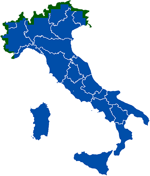
COVERAGE (last update June 27, 2025)
All the provinces of Italy are published including the area near the State Border, verified by the Geodetic Department with an update to June 2025, which had been excluded from previous publications.
DBSN coverage: in blue are the published areas, in green are the areas published with the latest update
How to
You do not need to be registered with the website to download the DBSN database.
Click on the link in the “Go to the service” section.
The download links will be presented on the screen. Regions, for convenience, have been divided into Provinces.
Make the download
What you need
It is not necessary to register with the website. Downloading is free
What you get
The download service, allows the DBSN data to be downloaded as geodatabase files (GDB extension) by Province. The data occupy slightly more space than the Province border to enable even those objects that cross the administrative border to be correctly identified.
The files are provided in zip format, so they must first be unzipped in order to access the contents.
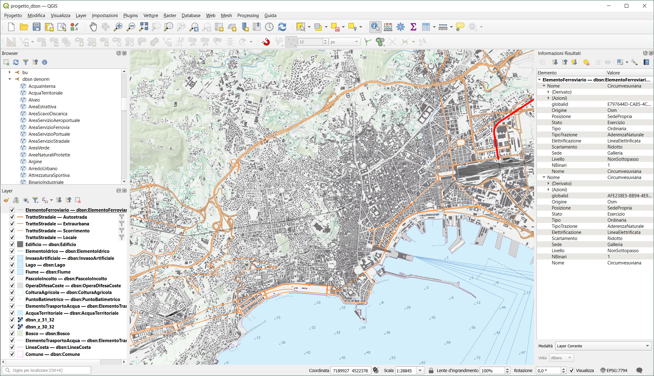
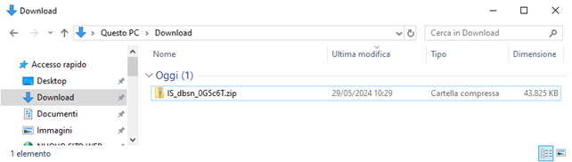
Example of a downloaded file:
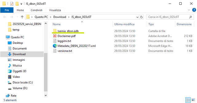
File contents after extraction process. The GDB file is highlighted.
A geodatabase file is a folder (directory) containing binary files capable of storing spatial and nonspatial data. The file can be read and viewed by GIS Desktop software. Take care to connect the entire folder and not its single files to the software (e.g., copy the file province.gdb to a local folder on the PC. After that, by means of the GIS software used, connect to the local folder, inside which the file province.gdb will be recognized as a geodatabase. It will then be possible to load the existing classes).
Visualization via GIS software of the geodatabase file, although modifiable in the default symbology, can be considered “rough.” If interested in visualizing the data with a cartographic dressing, we recommend the purchase of the 25DBSN Unsupervised Generation raster map, which is the map at scale 1:25,000 derived from DBSN data by IGMI through procedures of unsupervised cartographic generalization and application of the defined symbology.
The Database structure is based on technical specifications aligned with those established by national regulations (Decree November 10, 2011). The term “sintesi” (synthesis) refers to the selection of information and the simplification of the database structure: the content specifications of the DBSN are a sub-set of the “Catalogue of Spatial Data – Content Specifications for Geotopographic Databases”, which resulted in the reduction from 159 to 91 classes distributed in 10 layers (74 of which are releasable as the remaining ones have not been verified).
In the specifications, the META_IST attibute was introduced for all classes with a list of predefined domains representing an operational metadata indicating the source for each object entered. The specifications are currently being revised in alignment with INSPIRE guidelines.
“Catalogue of Spatial Data – Content Specifications for Geotopographical Databases,” annex to Ministerial Decree November 10, 2011, “Technical Rules for defining the Content Specifications for Geotopographic Databases” (Official Journal N° 48, 02/27/2012 – Ordinary Supplement N° 37).
Legislative Decree N° 36, January 24, 2006, as amended, on open data and reuse of public sector information.
Terms and Conditions
The database called DBSN (Database di Sintesi Nazionale) is made available under the Open Data Commons Open Database License (ODbL) ver. 1.0 https://opendatacommons.org/licenses/odbl/1-0/.
IGMI is not responsible for any kind of direct, indirect, or incidental damage resulting from the use of the information contained in the database.
Verto on Line is a software that carries out coordinates conversion, for free and in real time, between the most adopted reference systems in Italy: Roma 40, ED50 and ETRS89, this one in its two realizations, namely ETRF89 and ETRF 2000.
The DBSN (Database di Sintesi Nazionale – National Synthesis Database) is a geographic database containing the most significant spatial information to carry out thematic analysis and representations at national level.
The Web Map Tile Service (WMTS) is an open standard developed by the Open Geospatial Consortium (OGC) for the creation of geo-referenced “tile maps” sharing web services.
The Web Feature Service (WFS) is an open standard developed by the Open Geospatial Consotium (OGC) aimed at building web services for sharing geographic objects.
Pegaso VRS Now is a network of GNSS permanent stations, built by Trimble and certified by the Italian Military Geographic Institute, that provides immediate access to real-time NRTK corrections throughout Italy.
The Open Data Directive, introduced the “high-value” datasets. Their use can be associated with “important benefits for society, environment and economy”.
 Contattaci


