icona-ricerca_bg
icona-accedi-registrati_bg

Area riservata/Registrati

icona-lingua-ITA

It

Si informano i gentili utenti che, al momento, l’acquisto dei prodotti IGM è effettuabile esclusivamente tramite il sito ufficiale www.igmi.org
Il servizio di vendita diretta su questa piattaforma è in fase di implementazione e sarà reso disponibile prossimamente. Ci scusiamo per il temporaneo disagio.

Historical Maps

Consultation procedure

Our archive consists of over 300,000 aerial photos of the national territory. Find out how to search for the photo of your interest.

The Italian Military Geographic Institute preserves aerial photos of the national territory taken in the years between 1927 and 2010.

We are in the process of digitizing the archive.

Searching and consulting aerial photos can be done online, at https://igmi.esercito.difesa.it/foto-aeree/, for aerial photos taken in the years between 1936 and 2010.
For pre-1936 aerial photos, which cover extremely limited areas of the country, you must contact the Photographic Section by calling: +39 055 2732299 or by sending an e-mail request to
Purchasing information: photograms are not ready for immediate download. Once purchased they will be delivered to the customer presumably within 15 days.

Black/white or color aerial photographs

Choose the purchasing method of aerial photograms in black/white or color that you prefer.

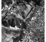
The stereoscopic aerial photographs of the national territory, yearly repeated, are taken using nadir photograms having photogrammetric characteristics, normally in the 23×23 cm. format, panchromatic (B&W) and at the approximate scale is 1:33,000 (varying in relation to the survey altitude). Since 1988, coverage of the national territory has been carried out with a camera equipped with Forward Motion Compensation and high-definition film. The photograms thus obtained, allow for better metric analysis and photographic interpretation of terrain’s details.

Digital images of aerial photographs.

They are obtained by scanning the entire photogram at 800, 2400 or 2500 DPI (Dot Per Inch). Specifically, for 2500 DPI resolution, the scan is obtained by transparency from the original, except for the images scanned from 30×30 cm format negatives, which can only be provided at the highest resolution of 2400 DPI.
They are provided in TIFF or PDF format:

- Digital image of the entire photogram in TIFF format

The entire photogram scan, in TIFF format, is available at three resolutions: 800, 2400 or 2500 DPI (Dot Per Inch) and is mainly intended for photointerpretation.

For photo interpretation research, 2400 and 2500 DPI scans are equivalent except for the geometric accuracy. This is obtained by photogrammetric scanning of the 2500 dpi product that allows stereoscopic uses. Scanning using a 2500 dpi photogrammetric scanner allows the use of stereoscopic (3D) methodologies in which at least two contiguous photograms are essential.

- Digital image of the entire photogram in authenticated PDF format

This product consists of a digital image of the entire photogram in high-resolution (2400 dpi) pdf format authenticated and digitally signed by an Italian Military Geographic Institute Executive/Officer.

The file contains within it all the identifying metadata of the photogram (year of flight, sheet n° at scale 1:100,000, flight strip-run n°, photogram n°.

This product can be, within the terms allowed and stipulated by law, wider used than photographic enlargements on paper.

False-color infrared aerial photographs

Stereoscopic photographic infrared aerial coverage consists of nadir false-color photograms, 23×23 cm format, at the approximate scale of 1:33,000, taken with cameras equipped with 152 mm focal length lens.
Purchasing Information: This product not is available for online purchasing.

Product Categories