Si informano i gentili utenti che, al momento, l’acquisto dei prodotti IGM è effettuabile esclusivamente tramite il sito ufficiale www.igmi.org
Il servizio di vendita diretta su questa piattaforma è in fase di implementazione e sarà reso disponibile prossimamente. Ci scusiamo per il temporaneo disagio.
The reference system is RDN2008/Italy Zone (Fuso Italia) E-N, EPSG 7794 (equivalent to RDN2008/Italy Zone (Fuso Italia) N-E, EPSG 6875). The frame shows the subdivision in degrees and primes of the flat cut of the map. Each element covers a mapped area of 18 by 14 km, and the total dimensions, including marginal labels, measure a physical size of 87.5 x 60 cm.
Map production is fully automated, with no subsequent interactive editing required. This approach allows with the availability of up-to-date data, rapid regeneration of the mapping.
Each map distributed in 3 formats: GeoPDF (300 DPI, CMYK colors), GeoTIFF (300 DPI, CMYK colors), and GeoTIFF (300 DPI RGB) without marginal wording.
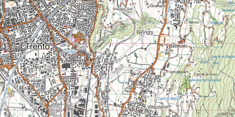
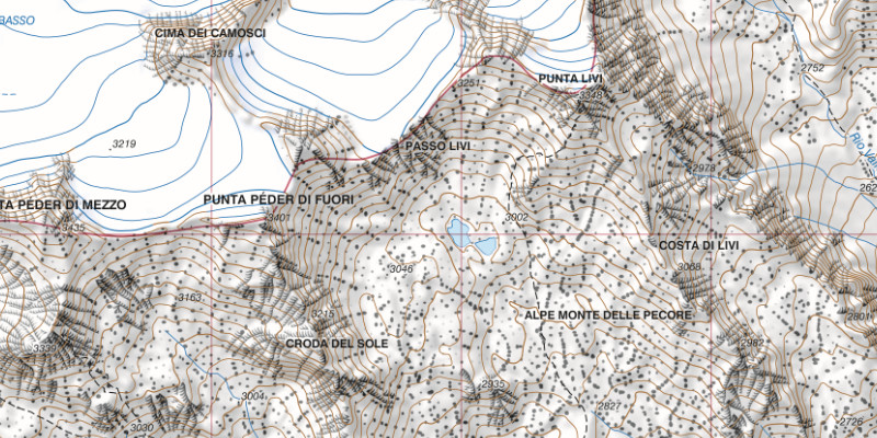
Cartographic detail with orographic data
Contents
Contents are mainly obtained from regional sources, integrated with data from the IGMI, other National Public Agencies, and data available on-line, such as Open Street Map;
The data displayed are the result of revisions based on the interpretation of orthophotos, not on direct field surveys;
The road network is updated for the main routes;
The administrative boundaries are derived from the cadastral ones, with adjustments made to ensure that municipal areas align with one another and with the state border;
The built-up area is detailed by primary land-use categories;
The toponymy is being updated and being standardized.
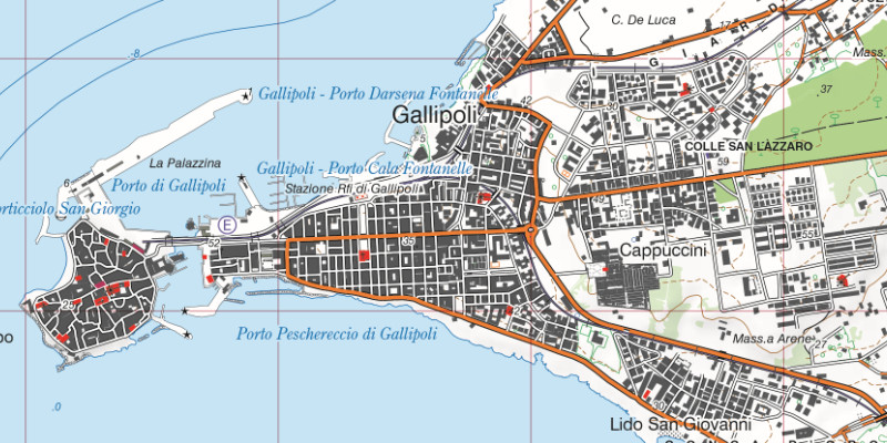
Cartographic detail of built-up area
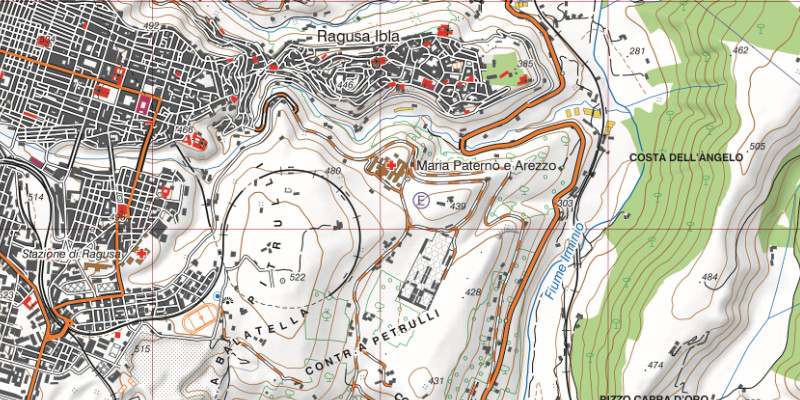
Cartographic detail with different color symbology
Notes on symbology
The symbology of the 1:25,000 scale map has been significantly revised from previous series. Although the style is rooted in IGM history, updates have been worked out according to the new types of features in the technical specifications.
The wealth of reference data has led to greater differentiation in the symbols used; for example, buildings are highlighted according to their use: religious, administrative, healthcare, agricultural, commercial, industrial, military, etc.
Symbols have been revised to highlight their logical grouping. For example, in many cases “color” classifies the object being represented: administrative components have been represented in “purple” (administrative boundaries, town halls, …), electricity-related objects in “electric blue” (power plants, power lines, substations, electrified railways), sports facilities in “red” (stadiums, tennis courts, various sports tracks, etc.), terrain features in “brown” (contour lines, embankments, slopes, sinkholes, etc.), and air transport components were depicted in “sky blue” (airports, heliports, runways, etc.).
Explore the Italian Military Geographic Institute’s aerial photo archive of the national territory and some foreign states: more than 300,000 photograms taken between 1927 and 2010.
Cartography
Discover the official cartography of Italy produced by IGMI: maps that are accurate, updated and made with state-of-the-art technology.
Historical maps
Discover a unique collection of vintage papers, perfect for scholars, collectors and enthusiasts.
Terrestrial Photos
Thousands of historical images, panoramic and terrestrial, taken between 1876 and 1945 in Italy and overseas territories.
Geodetic Elements and Conversion Software
Shop online for the technical quality of IGMI, the benchmark for geodesy in Italy.
Books and Journals
Deepen your knowledge of the territory with publications from the Italian Military Geographic Institute.