250 SERIES “Carta Regionale d’Italia” “Regional Map of Italy” 1:250,000 “IL FOGLIO”
TYPE
Map derived from scale 1:200,000 in 13 colors
CHARACTERISTICS
Orography is represented by shading and contour lines with contour intervals of 100 m. It shows Province, Region and the State overlapping borders in purple. Total and partial kilometric distances are indicated.
SCALE
1:250,000
SIZE
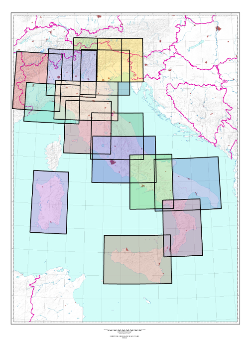
Variable size depending on Region size. One or two Italian regions are represented on each sheet.
NUMBER OF ELEMENTS
The Series consists of 15 elements, all of which are available.
END OF SERIES
Production ended in 2014
CUT
Geographic, based on ED50 Geodetic Reference System
ELLIPSOID
International
PROJECTION
Gauss-Boaga conformal projection (Transverse Mercator) 6° zones Coordinate reduction coefficient of 0.9996
Explore the Italian Military Geographic Institute’s aerial photo archives: more than 300,000 photograms of Italy and some foreign states, taken between 1927 and 2010.
Cartography
Discover the official cartography of Italy produced by IGMI: accurate and updated maps, all realized with state-of-the-art technologies.
Historical Maps
Discover a unique collection of historical maps, perfect for scholars, collectors and enthusiasts.
Terrestrial Photos
Thousands of historic, panoramic and terrestrial images of Italy and overseas territories, taken between 1876 and 1945
Geodetic Elements and Conversion Software
On line purchasing of high quality IGMI products.
Books and Magazines
Increase your knowledge of the territory by the Italian Military Geographic Institute’s publications.
 Contattaci

