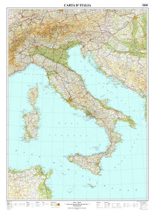
In the general version are indicated both natural landforms and main human settlements: it reports the main themes of transports (main road network, railways, ports, airports), hydrography (up to the IGMI 4th order, main lakes and reservoirs, glaciers), settlements (archaeological sites, historical and religious buildings), inhabited places classified by inhabitants and administrative importance as well as State and Region borders. Orography is represented with hypsometric tints, shading and elevation points.
In the physical version are represented natural landforms: this version reports in more detail the themes of hydrography, reliefs, the main geographic regions (massifs and mountains, plateaus, valleys, plains, seas, gulfs, peaks, capes, islands and archipelagos) with the related toponymy. It also shows the inhabited places up to Province capitals and State borders; orography is represented by hypsometric tints, shading and elevation points.
In the political version are depicted the main administrative aspects of the territory: State, Region and Province borders, main inhabited places up to Province capitals and up to Municipalities with more than 50,000 inhabitants (classified by administrative importance and population groups). Toponymy related to administrative units, main geographic regions and natural landforms is reported; orography is represented by shading.