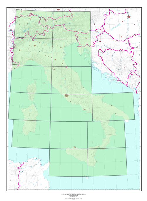
500 (1404) SERIES “IL MONDO” “THE WORLD” INTERNATIONAL MAP 1:500,000 “IL FOGLIO”
TYPE
Map produced by the British GSGS (currently DGC-UK). It is printed in 4 colors
CHARACTERISTICS
Orography is depicted by contour lines and hypsometric tints; State, Region, and Province borders are indicated. Cities are classified according to their importance; road network is classified according to the importance and nature of the road surface, distances are indicated in kilometers.
SCALE
1:500,000
SIZE
4° in Longitude by 2° in Latitude.
NUMBER OF ELEMENTS
The Series consists of 14 elements, all of which are available.
Explore the Italian Military Geographic Institute’s aerial photo archives: more than 300,000 photograms of Italy and some foreign states, taken between 1927 and 2010.
Cartography
Discover the official cartography of Italy produced by IGMI: accurate and updated maps, all realized with state-of-the-art technologies.
Historical Maps
Discover a unique collection of historical maps, perfect for scholars, collectors and enthusiasts.
Terrestrial Photos
Thousands of historic, panoramic and terrestrial images of Italy and overseas territories, taken between 1876 and 1945
Geodetic Elements and Conversion Software
On line purchasing of high quality IGMI products.
Books and Magazines
Increase your knowledge of the territory by the Italian Military Geographic Institute’s publications.
 Contattaci

