CARTA D’ITALIA (MAP OF ITALY) at scale 1:350,000 “IL FOGLIO”
CHARACTERISTICS
The map shows the main natural and anthropic aspects that are significant and relevant for the reference scale and useful for highlighting the general characteristics of the mapped territory at regional scale. The information reported can be grouped into themes: Elevation, Hydrography, Borders, Transports, Inhabited Places, Settlements, Protected Areas, Named Places. Elevation is represented by hypsometric tints, contour lines and elevation points with the addition of the shading that enhances the effect of the relief.
SCALE
1:350,000
NUMBER OF ELEMENTS
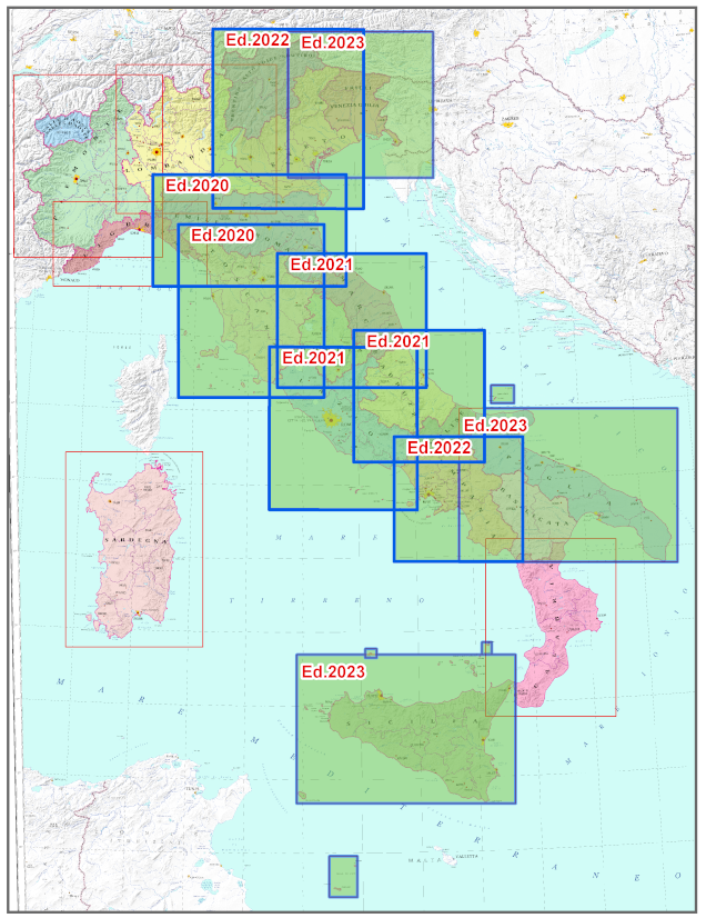
The Series consists of 15 elements, not all of which are available
START OF SERIES PRODUCTION
Year 2020
CUT
Rectangular plan according to the RDN2008-Italy-Zone projection
REFERENCE SYSTEM
ETRF2000 (2008.0) (European Terrestrial Reference Frame 2000 at epoch 2008)
PROJECTION
RDN2008-Italy-Zone (Transverse Mercator representation on a single national time zone with origin of the coordinates on the 12° meridian – EPSG6875)
Explore the archive of aerial photos of the Military Geographic Institute: over 300,000 photograms of the national territory and some foreign countries, taken between 1927 and 2010.
Cartography
Discover the official cartography of Italy produced by IGMI: accurate, up-to-date maps made with cutting-edge technologies.
Historical Maps
Discover a unique collection of historical maps, perfect for scholars, collectors and enthusiasts.
Terrestrial Photos
Thousands of historical, panoramic and terrestrial images of Italy and overseas territories, taken between 1876 and 1945.
Geodetic Elements and Conversion Software
Online purchasing of high-quality products realized by IGMI, a reference point for geodesy in Italy.
Books and Magazines
Learn more about the territory with the Italian Military Geographic Institute’s publications.
 Contattaci

